Oslo Gardermoen Airport (OSL)
Orientation and Maps
(Oslo, Norway)
The capital of Norway, Oslo is home to a population of more than 500,000. With mainly modest architecture and many appealing districts, Oslo is located alongside the head of the region's Oslofjord inlet, lying to the east of Baerun and to the west of Lorenskog.
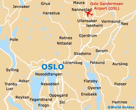
On the northern side of Oslo you will find the North Woods, which are known locally as the Nordmarka and boast an array of recreational activities, including seasonal skiing. Further north-east is Oslo Gardermoen Airport (OSL), which is easy to reach along a number of fast and scenic roads.
Oslo Airport (OSL) Maps: Important City Districts
Many impressive areas of green can be found both in and around the city of Oslo. The main train station is located on the eastern side and is known as the 'Oslo Sentralstasjon', being close to Karl Johans gate, an important point of reference.
Many of Oslo's main sightseeing opportunities are just a short walk from the gate and include a number of waterfront attractions, next to the harbour area, with many local shops and top restaurants offering appealing views. Of particularly interest, the Akershus Festning castle dominates much of this area and can be accessed via a drawbridge next to the Kongens gate.
The Oslo Promotion tourist centre and the Brynjulf Bulls Plass 1 is open daily and provides a useful map of the city, which also includes a stylised map of the Tunnelbanen underground train network (T-bane).
Norway Map

Oslo Map